")
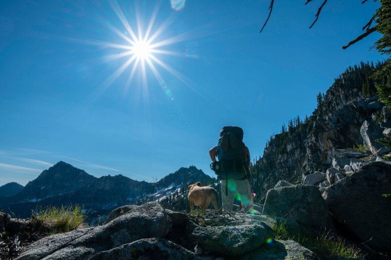
John, Ruby and I headed for Fitsum Summit to escape the 4th of July crowds which have invaded McCall. It wasn’t long before we left all the people behind and had our own private Idaho! See John’s trip report here.

After about 3 hours and 7 miles, we set up camp and prepared for our assault of Mount Horrendous. John prepared a delicious dinner of sausage and red beans and rice….. John may be one of the most experienced back country hikers living in the Northwest but I really question his meal selection given we were sharing the same tent.

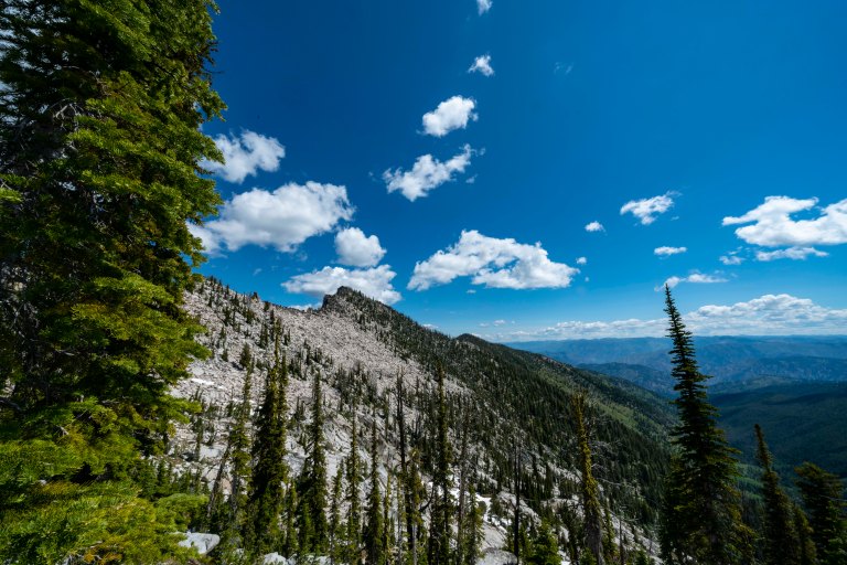
The following morning, we packed up camp and started moving up the mountain. It wasn’t long before we left the trail and headed up the ridge to our high camp. Here is one of our first views of Mount Horrendous (off in the distance left) and The Spear (just over Ruby’s head). If you look carefully at the summit of The Spear, you can see its namesake.
We crested the high saddle and looked down on our home for the next evening. That is The Spear, just under the sun. Our camp ended up on a bare spot in the trees center image.

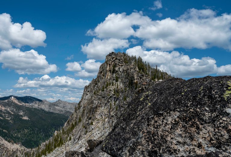
Here is a close up of The Spear and you can see why we gave it this name.

Headed down into our basin with our two mountain objectives in the background.
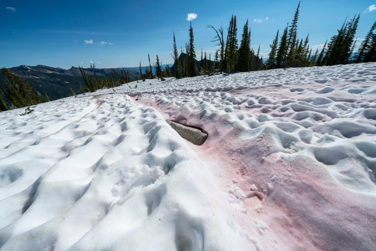
Don’t eat the red snow! Watermelon snow, also called snow algae, pink snow, red snow, or blood snow, is a phenomenon caused by Chlamydomonas nivalis, a species of green algae containing a secondary red carotenoid pigment (astaxanthin) in addition to chlorophyll…. Also advisable to not eat the yellow snow (not pictured here).
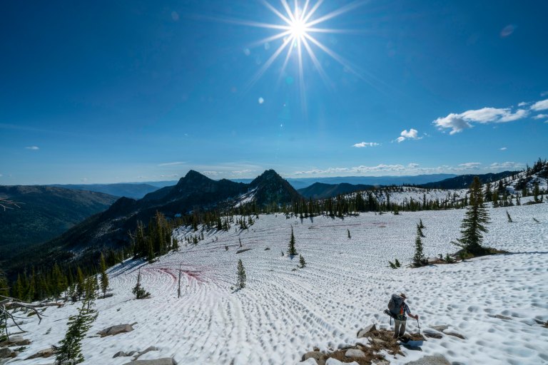
We searched the basin, found a suitable bare spot, pitched our tent (so we could find it on our return), and headed off to climb our mountains. As we left camp, John throws out something like: “We should be able to knock out The Spear in about 30 minutes. Notice The Spear coming more into view with the wide angle images, with Horrendous just off its left shoulder.
After searching for a plausible route up The Spear, we decided to circle around its base, climb Horrendous and hope for an easier route up The Spear on the back side. Spoiler alert, there is no easy route up to The Spear and the one we found took far more than 30 minutes! We turned the corner to find this talus field and the summit of Horrendous. Remember, this is a wide angle lens and many of the blocks in that talus field are the size of houses! Turns out, climbing Mount Horrendous is really hard!
Views of Nick Peak looking back from where we came.

John, carefully making his way to the actual summit. Right below and in front of him is Lake Thirty Three, a beautiful hanging lake far off in the distance.

A blow up of Lake Thirty Three.

Off to The Spear, here is a view of Horrendous, looking back on the decent.
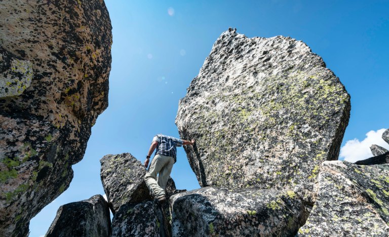
And, more than 30 minutes later, here is John with his hand on The Spear!
Now back down to high camp. Total round trip for the two peaks from our high camp was more than 5 hours.

Y’all come back soon to see part 2 of this trip!
